
Maps of the Smoky Mountains
Let What-To-Do help you find your way around Gatlinburg, Pigeon Forge, Sevierville and Townsend, Tennessee and the Great Smoky Mountains National Park. We have area maps, trolley maps and hiking maps for your convenience. Select a single map to print or print them all!
Trolly Map

Click map to view larger or to print out.
In the Smoky Mountain area, trolleys serve hundreds of locations throughout Gatlinburg, Pigeon Forge and Sevierville.
The Sevierville/Pigeon Forge trolley runs daily 8:30 – midnight from early March through October and 10:00 am – 10:00 pm in November and December. Gatlinburg trolley runs daily as follows: March – April 10 am – 10 pm, May – October 8 am – 12 am.
Hiking Map
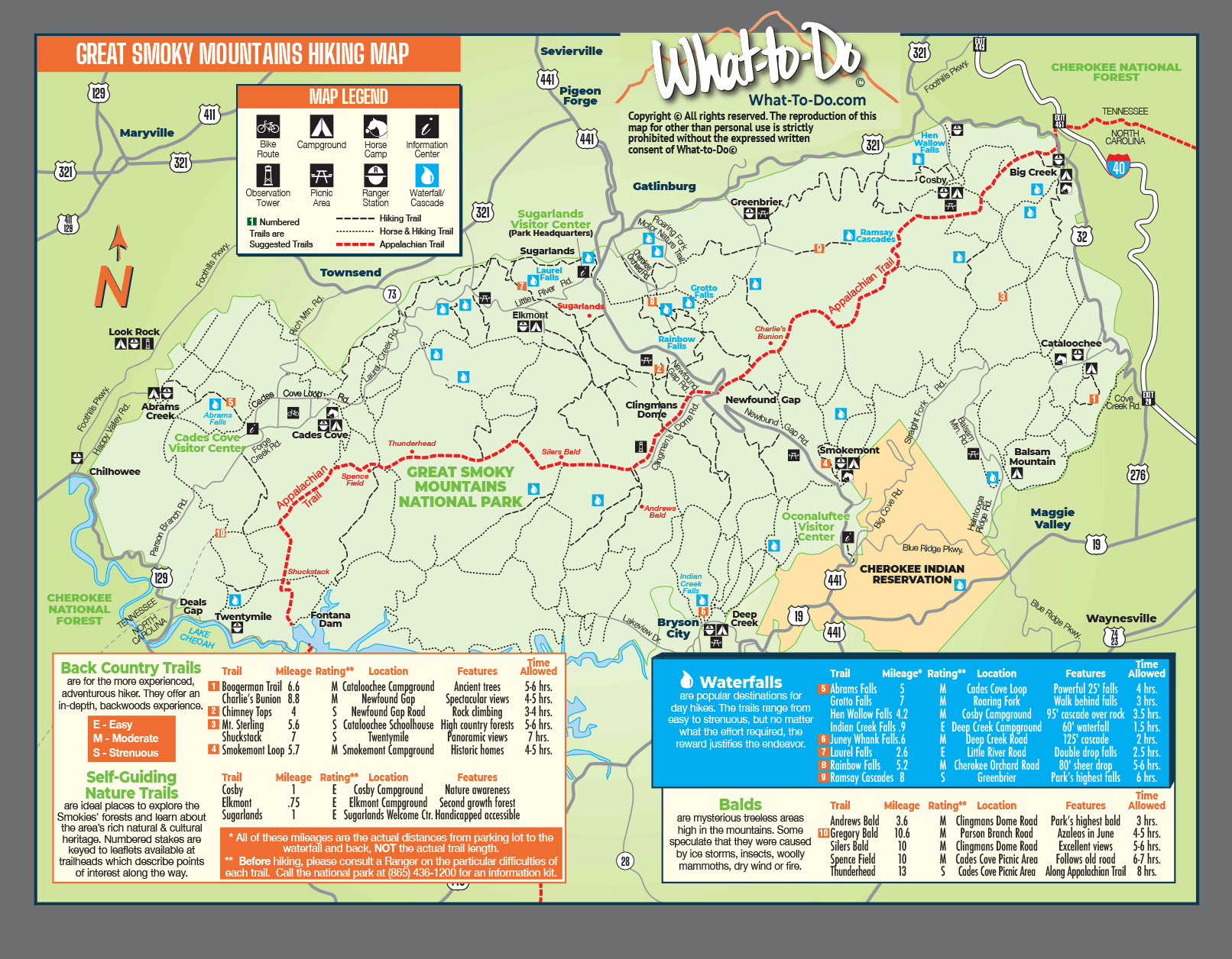
Click map to view larger or to print out.
Waterfalls, Balds, Back Country Trails and Self-Guiding Nature Trails, whether you want a lite family trek, day hikes or you are a hardcore hiker we have the Smoky Mountains Hiking Map for you.
Our maps have Trail Ratings, Distance and Features that make each trail unique. With Visitor Center locations, Information Centers, Ranger Stations, Picnic Areas and more!
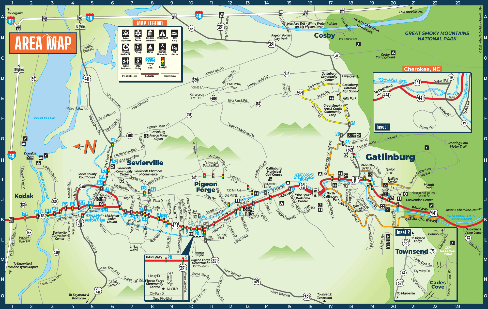
Smoky Mountains Area Map
Click map to view larger or to print out.
Map of Kodak, Sevierville, Pigeon Forge, Townsend and Gatlinburg. This is a detailed map including traffic lights, mile markers, parks, public buildings, parking, hospitals and more.
Theater Map
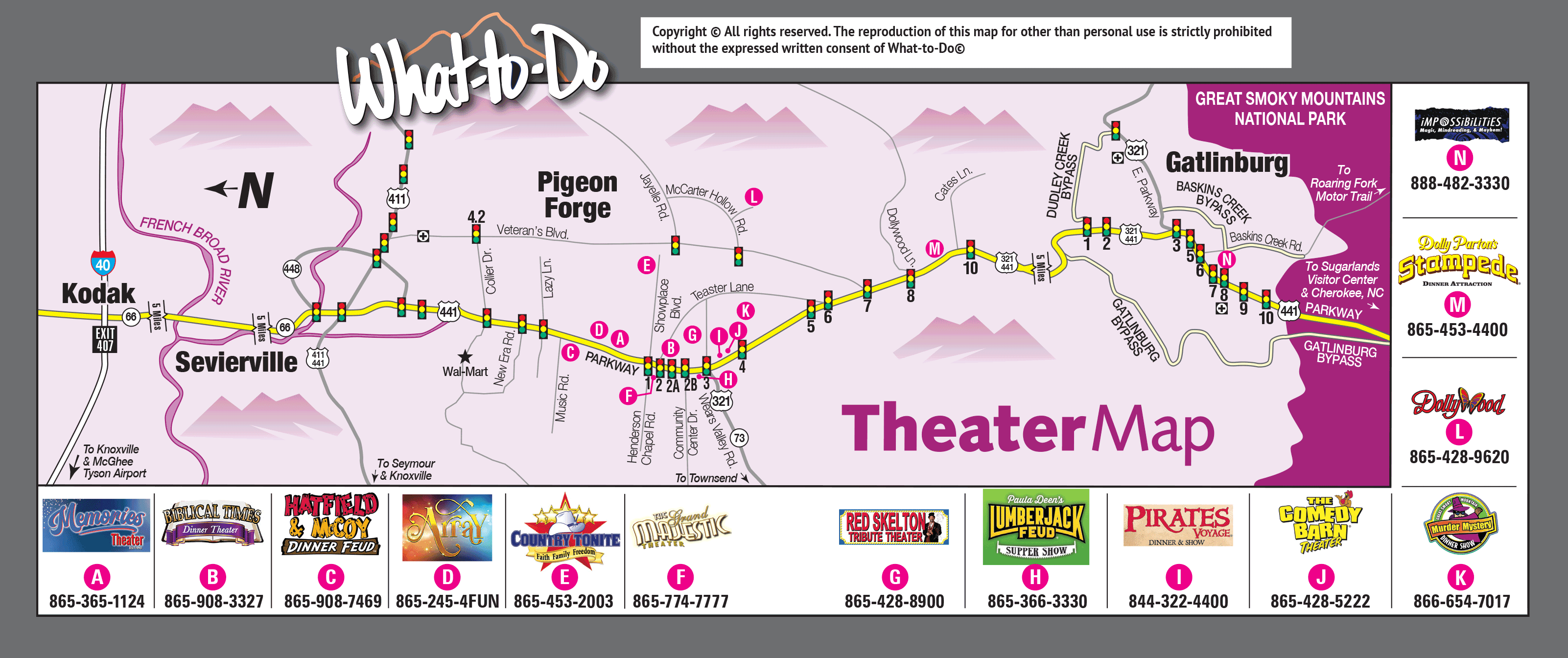
Click map to view larger or to print out.
Map showing you the popular shows and theaters in the Smoky Mountains